Hydrology and water quality
Hydrologic and water quality modeling forms the foundation of much of our work. We implement models at scales ranging from single farm fields to continental-scale major river basins composed of an assortment of land uses and land management practices. The modeling approaches we adopt can be simple or complex, and are tailored to fit each project.
Our hydrologic and water quality modeling work is enhanced by Stone’s field work expertise in the areas of Agricultural Stewardship, Agrochemical Fate & Exposure, and Water Quality . The synergy of these teams results in a more holistic and comprehensive understanding of the environmental data and issues when developing solutions for our clients.
-
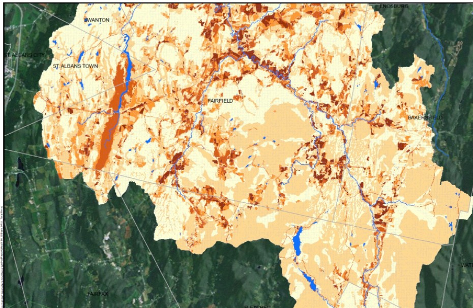
HRU Map
-
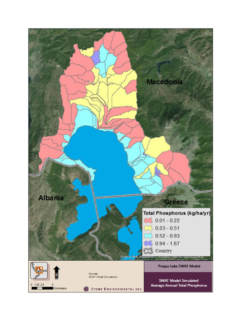
Lake Prespa, Macedonia
-
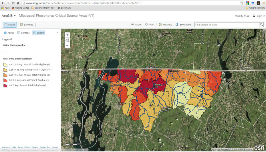
Web Mapping of SWAT Output
-
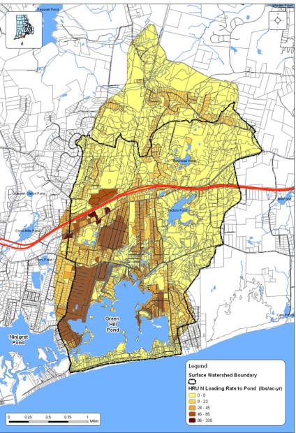
Watershed Nitrogen Modeling
-
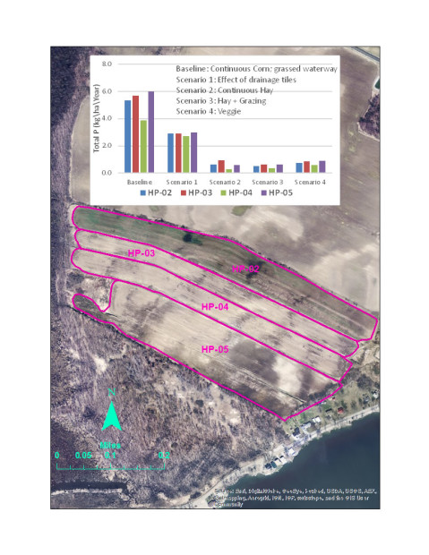
Conservation Practice Sim
The issues we address include:
- Watershed scale nutrient critical source area identification
- TMDL allocation strategies for nutrients and agrochemicals
- Sediment transport from upland and riverine sources
- Impacts of climate change on water quality
- Watershed scale benefits of agricultural and non-agricultural best management practices
- Farm scale analysis of conservation practice implementation
- Water supply planning
Addressing these issues can require the use of both standard “off-the-shelf” tools and customized models.
We are experts in many of the most widely used hydrologic and water quality models, including:
- SWAT (Soil and Water Assessment Tool)
- APEX (Agricultural Policy/Environmental Extender Model)
- VFSMOD (Vegetative Filter Strip Model)
- SWMM (Stormwater Management Model)
The integration of spatial datasets and GIS analysis in our modeling is essential. Stone’s Geospatial & Data Solutions team brings additional layers of expertise into many of our hydrologic and water quality modeling projects.
We have extensive experience working with National scale environmental datasets to support model development and application, including:
- NED (National Elevation Dataset)
- NHD (National Hydrography Dataset)
- NHDPlus (National Hydrography Dataset Plus value added attributes)
- NLCD (National Landcover Database)
- CDL (NASS Cropland Data Layer)
- SSURGO (NRCS Soil Survey Geographic Database)